
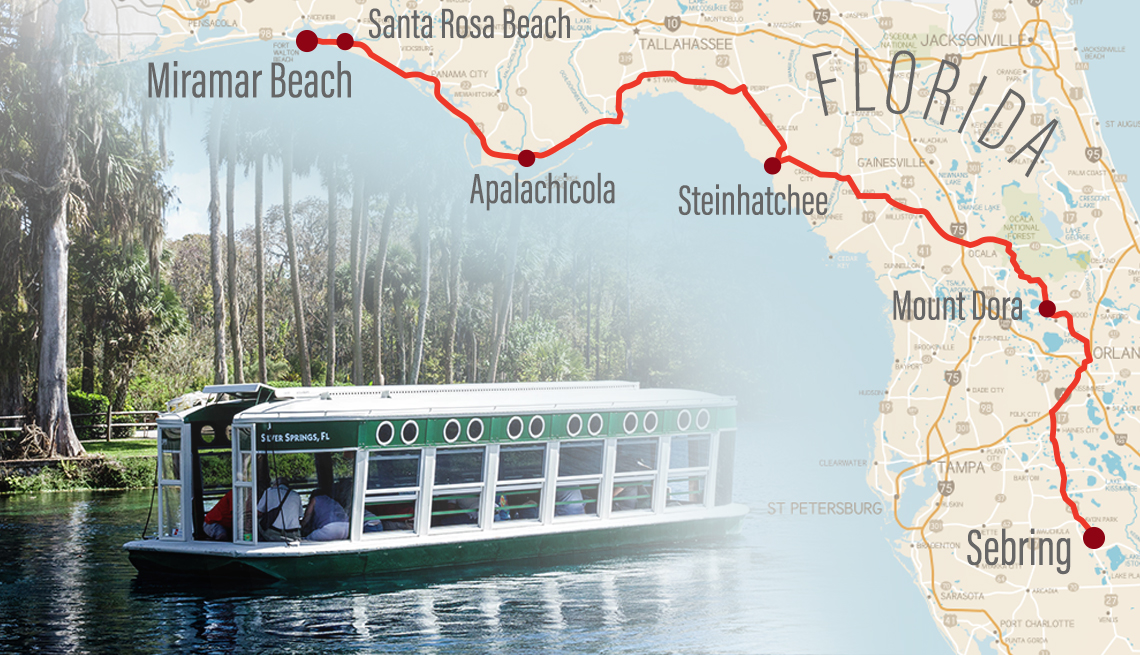
The city map of Florida Panhandle shows you every major city and road in this amazing region. Finding your way around Northwest Florida can be tricky without the right map.
You need clear directions to explore Pensacola, Tallahassee, Panama City, and dozens of other cities.
This guide gives you everything you need to navigate the Florida Panhandle like a local expert.


What Is the Florida Panhandle?
The Florida Panhandle stretches across the northwest part of Florida.
This region looks like a “handle” on a pan when you see it on a map.
The Panhandle covers about 200 miles from east to west.
It sits between Alabama, Georgia, and the Gulf of Mexico.
Most people call this area Northwest Florida or the Emerald Coast.
The region has 23 counties total.
Each county has its own unique cities and attractions.
Geography of the Florida Panhandle
- The Florida Panhandle has three main geographic regions.
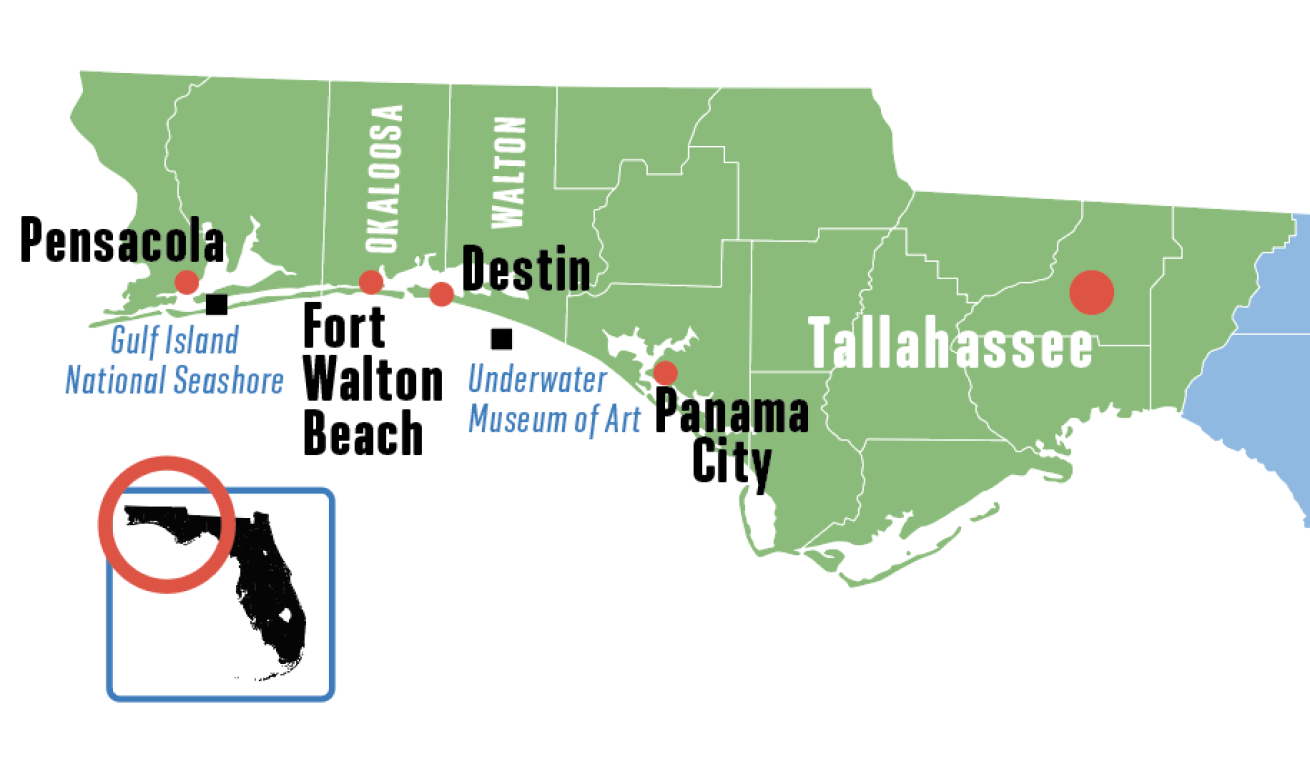
- The western section includes Escambia and Santa Rosa counties.
- The central area covers Okaloosa, Walton, and Bay counties.
- The eastern part stretches from Leon County to the Suwannee River.
- Rolling hills cover much of the inland areas.
- Beautiful beaches line the Gulf Coast for over 100 miles.
- Pine forests and wetlands fill the northern sections.
Major Cities in the Florida Panhandle
Tallahassee – The Capital City
- Tallahassee serves as Florida’s state capital.
- The city sits in Leon County with over 194,000 people.
- Florida State University and Florida A&M University call this city home.
- Government buildings and college campuses dominate the landscape.
- Rolling hills surround the city center.
- Canopy roads with massive oak trees create stunning drives.
Key Features of Tallahassee:
- Population: 194,500 residents
- Founded: 1824
- Elevation: 203 feet above sea level
- Major highways: I-10, US-27, US-319
- Universities: FSU, FAMU, TCC
Pensacola – Military and Beach Town
- Pensacola sits in Escambia County near the Alabama border.
- The city has about 54,000 people in the main area.
- Naval Air Station Pensacola trains Navy and Marine pilots.
- Historic downtown Pensacola features brick streets and old buildings.
- Pensacola Beach offers sugar-white sand and emerald waters.
- The Blue Angels flight team practices here year-round.
Pensacola Statistics:
- Population: 54,312 residents
- Founded: 1559 (oldest European settlement in US)
- Military personnel: 16,000+ at NAS Pensacola
- Annual visitors: 3.2 million tourists
- Beach length: 8 miles of coastline
Panama City – Spring Break Capital
- Panama City sits in Bay County along the Gulf Coast.
- The city proper has around 36,000 residents.
- Panama City Beach draws millions of visitors each year.
- The area rebuilt stronger after Hurricane Michael in 2018.
- Tyndall Air Force Base protects the eastern side of the city.
- Shopping, dining, and water sports dominate the economy.
Panama City Facts:
- Population: 36,877 residents
- Beach visitors: 4.5 million annually
- Pier length: 1,206 feet (longest in Gulf)
- Average temperature: 68°F year-round
- Hurricane Michael damage: $25 billion in 2018
Destin – Fishing Village Turned Tourist Haven
- Destin sits in Okaloosa County on the Emerald Coast.
- This former fishing village now has about 14,000 residents.
- The area claims to be the “World’s Luckiest Fishing Village.”
- Destin-Fort Walton Beach Airport serves the region.
- Harbor Walk Village offers shopping and dining by the water.
- Crab Island sandbar attracts boaters every weekend.
Destin Highlights:
- Population: 14,490 residents
- Charter fishing boats: 140+ vessels
- Annual seafood caught: 24 million pounds
- Hotel rooms: 15,000+ accommodations
- Average home price: $650,000
Fort Walton Beach – Military Community
- Fort Walton Beach sits next to Eglin Air Force Base.
- The city has approximately 22,000 residents.
- Eglin AFB covers 464 square miles of land.
- The base employs over 60,000 military and civilian workers.
- Beaches here offer fewer crowds than Panama City.
- The area specializes in military testing and training.
Fort Walton Beach Data:
- Population: 22,144 residents
- Eglin AFB size: 464 square miles
- Military employees: 60,000+ personnel
- Beach access points: 12 public areas
- Tourism revenue: $1.8 billion annually
Gainesville – College Town
- Gainesville sits in Alachua County in the eastern Panhandle.
- The University of Florida dominates this city of 140,000 people.
- Gator Nation brings energy and excitement year-round.
- Medical facilities and research centers drive the economy.
- Historic downtown offers local shops and restaurants.
- Natural springs and state parks surround the area.
Gainesville Overview:
- Population: 140,212 residents
- UF students: 52,000+ enrolled
- Major employer: University of Florida (32,000 employees)
- Hospitals: 4 major medical centers
- Annual economic impact: $16.9 billion
Main Roads and Highways
Interstate 10 (I-10)
- Interstate 10 runs east-west across the entire Florida Panhandle.
- This major highway connects Jacksonville to Pensacola.
- The road spans 362 miles through North Florida.
- I-10 passes through Tallahassee, Lake City, and Madison.
- Most east-west travel uses this important route.
- Speed limits reach 70 mph in rural areas.
I-10 Quick Facts:
- Total length in Florida: 362 miles
- Daily traffic: 50,000+ vehicles
- Major cities served: 8 metropolitan areas
- Rest stops: 12 official facilities
- Construction cost: $2.3 billion (original)
US Highway 98
- US Highway 98 follows the Gulf Coast from Pensacola to Crystal River.
- This scenic route connects all beach communities.
- The road runs right along the water in many sections.
- Tourists use US-98 to visit multiple beach towns.
- Traffic gets heavy during summer months and spring break.
- Many restaurants and hotels line this coastal highway.
US-98 Features:
- Length along coast: 220 miles
- Beach towns connected: 15+ communities
- Scenic overlooks: 25 designated spots
- Daily summer traffic: 35,000 vehicles
- Speed limit: 35-55 mph through towns
State Road 85
- State Road 85 runs north-south through the central Panhandle.
- The highway connects I-10 to the beaches near Fort Walton.
- This route passes through Crestview and other inland towns.
- Many military personnel use SR-85 daily.
- The road provides access to Eglin Air Force Base.
- Shopping centers and restaurants cluster along this highway.
US Highway 331
- US Highway 331 connects I-65 in Alabama to the Florida beaches.
- This route brings many Alabama visitors to the coast.
- The highway passes through DeFuniak Springs and Freeport.
- Traffic increases dramatically on summer weekends.
- Many visitors call this the “Alabama Beach Highway.”
- Gas stations and convenience stores serve travelers along the route.
Counties in the Florida Panhandle
Western Panhandle Counties
Escambia County Pensacola serves as the county seat.
Population reaches about 321,000 residents.
Naval Air Station Pensacola anchors the local economy.
The county includes Pensacola Beach and Gulf Islands National Seashore.
Santa Rosa County Milton serves as the county seat.
Population grows rapidly with about 188,000 residents.
Many residents commute to Pensacola or Eglin AFB for work.
Navarre Beach offers quieter alternatives to Pensacola Beach.
Okaloosa County Crestview serves as the county seat.
Population includes about 211,000 residents.
Eglin Air Force Base drives much of the local economy.
Fort Walton Beach and Destin bring tourism dollars.
Central Panhandle Counties
Walton County DeFuniak Springs serves as the county seat.
Population reaches approximately 75,000 residents.
The county includes parts of Destin and all of South Walton.
Scenic Highway 30A connects beach communities here.
Bay County Panama City serves as the county seat.
Population includes about 175,000 residents.
Hurricane Michael caused major damage in 2018.
The area continues rebuilding with newer, stronger construction.
Gulf County Port St. Joe serves as the county seat.
Population stays small with only 15,000 residents.
The county offers quiet beaches and fishing opportunities.
Cape San Blas provides some of the most beautiful beaches in Florida.
Eastern Panhandle Counties
Leon County Tallahassee serves as the county seat and state capital.
Population includes about 295,000 residents.
Government jobs and universities drive the economy.
Rolling hills and canopy roads define the landscape.
Jefferson County Monticello serves as the county seat.
Population stays rural with about 14,000 residents.
Agriculture and timber provide most local jobs.
Historic plantations attract some tourists.
Madison County Madison serves as the county seat.
Population includes about 18,000 residents.
Farming and small businesses support the local economy.
The county sits along the Georgia border.
Best Routes for Travelers
Beach Hopping Route
- Start in Pensacola and head east on US-98.
- Visit Pensacola Beach, then continue to Navarre Beach.
- Stop in Destin for shopping and dining.
- End in Panama City Beach for nightlife and attractions.
- This route covers about 150 miles of coastline.
- Plan at least 3-4 days to see everything properly.
Historic Towns Tour
- Begin in Tallahassee to see the state capitol.
- Drive north to Monticello for antique shopping.
- Head west to DeFuniak Springs for Victorian architecture.
- End in Pensacola for colonial history and museums.
- This route showcases Florida’s inland heritage.
- Each town offers unique historical attractions.
Military Heritage Trail
- Start at Naval Air Station Pensacola.
- Visit the National Naval Aviation Museum.
- Drive east to Eglin Air Force Base near Fort Walton Beach.
- Tour the Air Force Armament Museum.
- Continue to Tyndall AFB near Panama City.
- This route honors military history and sacrifice.
Nature and Parks Route
- Begin at Gulf Islands National Seashore near Pensacola.
- Visit Blackwater River State Park for canoeing.
- Stop at Eden Gardens State Park in Point Washington.
- End at St. Andrews State Park in Panama City.
- This route showcases natural Florida beauty.
- Each park offers different outdoor activities.
Transportation Options
Airports in the Region
Pensacola International Airport (PNS) Serves the western Panhandle region.
Multiple airlines offer daily flights.
The airport handles about 1.2 million passengers annually.
Rental cars and shuttles connect to local hotels.
Destin-Fort Walton Beach Airport (VPS) Serves the central tourist areas.
Seasonal flights increase during summer months.
The airport processes about 1.8 million passengers yearly.
Many vacation rental companies offer airport pickup.
Tallahassee Regional Airport (TLH) Serves the capital city and eastern Panhandle.
Government officials and university visitors use this airport frequently.
The facility handles about 800,000 passengers annually.
Downtown Tallahassee sits just 10 minutes away.
Northwest Florida Beaches International Airport (ECP) Newest airport serving Panama City area.
Opened in 2010 to replace older facilities.
The airport serves about 1.5 million passengers yearly.
Modern facilities include shops and restaurants.
Public Transportation
- Most Panhandle cities offer limited public bus service.
- Pensacola operates Escambia County Area Transit (ECAT).
- Tallahassee runs StarMetro bus service for residents and students.
- Beach areas rely mostly on private transportation.
- Ride-sharing services operate in larger cities.
- Taxi service exists but remains limited outside downtown areas.
Rental Car Information
- All major airports offer multiple rental car companies.
- Summer reservations should be made well in advance.
- Beach areas see higher rental prices during peak season.
- Many hotels offer shuttle service to rental locations.
- One-way rentals between cities are usually available.
Climate and Best Times to Visit
Year-Round Weather Patterns
- The Florida Panhandle enjoys a subtropical climate.
- Average temperatures range from 45°F in winter to 85°F in summer.
- Humidity stays high throughout most of the year.
- Gulf breezes provide some relief during hot months.
Monthly Temperature Averages:
- January: 45-65°F
- April: 60-78°F
- July: 75-88°F
- October: 65-80°F
Hurricane Season Considerations
- Hurricane season officially runs from June 1 to November 30.
- Peak activity occurs between August and October.
- The Panhandle faces threats from Gulf storms.
- Hurricane Michael devastated parts of the region in 2018.
- Building codes now require stronger construction standards.
- Emergency evacuation routes are clearly marked.
Best Visiting Seasons
Spring (March-May) Temperatures stay comfortable for outdoor activities.
Fewer crowds mean better hotel rates and restaurant availability.
Wildflowers bloom throughout inland areas.
Spring break brings college students to beach areas.
Summer (June-August) Peak tourist season with highest prices.
Beach activities and water sports reach their prime.
Daily afternoon thunderstorms provide brief cooling.
Hotel reservations should be made months in advance.
Fall (September-November) Hurricane risk decreases after mid-October.
Temperatures remain warm enough for beach activities.
Fall festivals occur throughout the region.
Hotel rates drop significantly after Labor Day.
Winter (December-February) Coolest temperatures but still mild by northern standards.
Perfect weather for hiking and outdoor exploration.
Lowest hotel rates and smallest crowds.
Some attractions reduce hours or close temporarily.
Tips for Using City Maps
Digital Map Applications
- Google Maps provides real-time traffic updates.
- Apple Maps works well for iPhone users.
- Waze offers crowdsourced traffic and police alerts.
- AllTrails helps find hiking and nature trails.
- Download offline maps before traveling to remote areas.
Physical Map Resources
- Visitor centers offer free regional maps.
- AAA members can request detailed road maps.
- State parks provide trail maps and area information.
- Hotels usually stock local attraction maps.
- Gas stations sell detailed road atlases.
Navigation Challenges
- Beach traffic moves slowly during peak hours.
- Construction projects can cause unexpected delays.
- Some rural roads lack clear signage.
- GPS signals may be weak in heavily forested areas.
- Bridge openings can delay travel along waterways.
Local Driving Tips
- Speed limits change frequently through small towns.
- School zones require reduced speeds during specific hours.
- Beach parking fills up early during summer weekends.
- Toll roads are rare but do exist on some bridges.
- Wildlife crossing signs should be taken seriously.
Future Development Plans
Infrastructure Improvements
- Highway widening projects continue throughout the region.
- New bridges replace aging structures over waterways.
- Airport expansions accommodate growing passenger numbers.
- Bike paths and walking trails connect communities.
Tourism Growth
- New hotels and resorts are planned for beach areas.
- Attraction developers eye inland opportunities.
- Convention centers expand to host larger events.
- Marketing campaigns target international visitors.
Environmental Protection
- Beach restoration projects protect shorelines.
- State parks acquire additional conservation land.
- Water quality monitoring increases along the coast.
- Sustainable tourism practices gain support from businesses.
FAQs
What is the nicest area of the Florida Panhandle?
Destin and Santa Rosa Beach are often considered the nicest, known for their white-sand beaches, upscale amenities, and scenic Gulf views.
What areas are in the Florida Panhandle?
The Panhandle includes cities and towns from Pensacola to Apalachicola, covering places like Destin, Panama City, Fort Walton Beach, and Tallahassee.
What cities are near the Florida Panhandle?
Nearby cities include Mobile, AL, and Dothan, AL. Within Florida, Tallahassee, Pensacola, and Panama City are central Panhandle cities.
How far is Tampa from the Florida Panhandle?
Tampa is roughly 325–400 miles from Panhandle cities like Pensacola or Destin, with a drive time of 5 to 6.5 hours, depending on location.
What is the cheapest town to live in the Florida Panhandle?
Crestview and Milton are among the most affordable, offering lower housing costs while still within reach of Gulf Coast amenities.
What is the safest city in the Florida Panhandle?
Niceville consistently ranks as one of the safest cities, known for low crime, good schools, and a family-friendly atmosphere.
Conclusion
The city map of Florida Panhandle reveals a diverse region with something for everyone.
From the white sand beaches of the Emerald Coast to the rolling hills around Tallahassee, this area offers incredible variety.
Major cities like Pensacola, Panama City, and Destin provide urban amenities and attractions.
Smaller towns offer authentic Florida charm and hospitality.
Interstate 10 and US Highway 98 make travel between destinations simple and straightforward.
Whether you’re interested in military history, college sports, outdoor recreation, or beach relaxation, the Florida Panhandle delivers.
Plan your route using the information in this guide to make the most of your visit.
The region continues growing and improving while maintaining its natural beauty and cultural heritage.
Your Florida Panhandle adventure awaits – just grab a map and start exploring.


